Introduction
Take care of the land. Someday, you’ll be part of it.
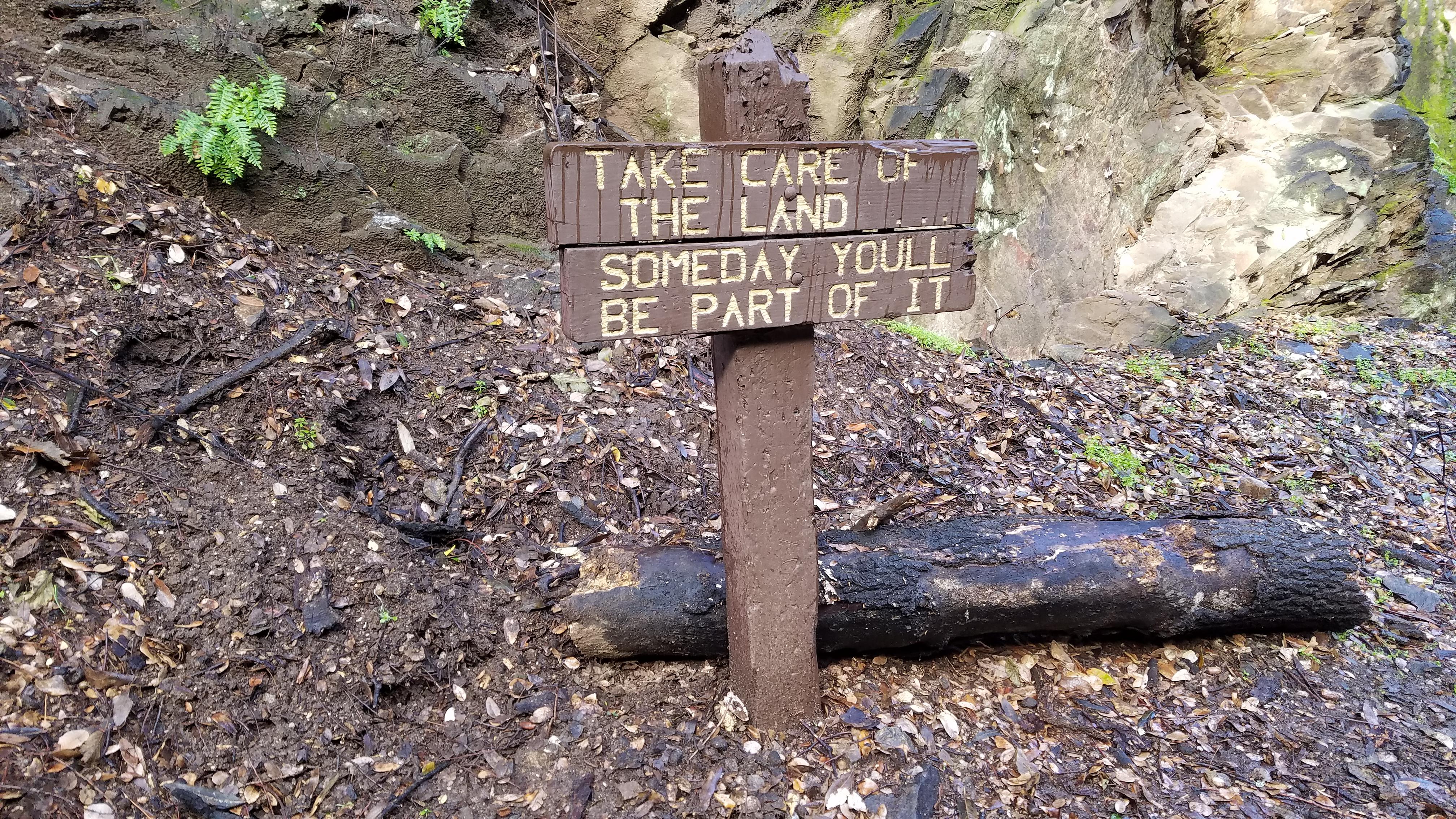
This sign, posted without attribution, made an impression on me since I first began hiking Santa Anita Canyon many years ago.

If I had to make one change to it, though, it might be to add the word “again”, as in, “Take care of the land. Someday, you’ll be part of it, again.”

Why “again”?

On the one hand, ten billion years ago, we were just stardust, drifting in space. Ten billion years from now, we’ll once again be stardust doing the same. The planet earth is only about 4.5 billions years old.

Our own star, the sun, also formed out of stardust. It is expected to collapse and perhaps explode in about 7.5 billion years from now. Back to stardust, again.

Life on earth will have long perished before then. If we have not destroyed ourselves, hopefully, inter-planetary travel will allow our descendants to colonize other galaxies and escape this doomsday scenario, whatever evolved form they may take.

On the other hand, there is no question food becomes us. We feed on living plants and animals for our nutrients. Ultimately, plants and animals get the nutrients from the soil and the sun. Once we’re buried and people stop looking after our graves, perhaps some centuries from now, our bodies will become one with the land again.

If we choose cremation instead and our ashes are dispersed into the wild (my preference), the process would come faster.

So the sign, which has been there for a long time, reminds us to take care of the environment and treat it as if we are part of it. We come from the dirt and we will once again, one way or another, return to the dirt. It’s the cosmic great circle of life. You tread on your past ancestors and someday your descendants will tread on you. So take care of it.

The Day
On this day, my friend Alex accompanied me once again. It was his 2nd time doing “real” hiking after we went to the Ski Hut in Baldy couple of weeks ago. This time around, he was breaking in “real” hiking shoe and clothes. Actually, hiking is a very democratic activity, anyone can go to the mountain with or without name brand attire.
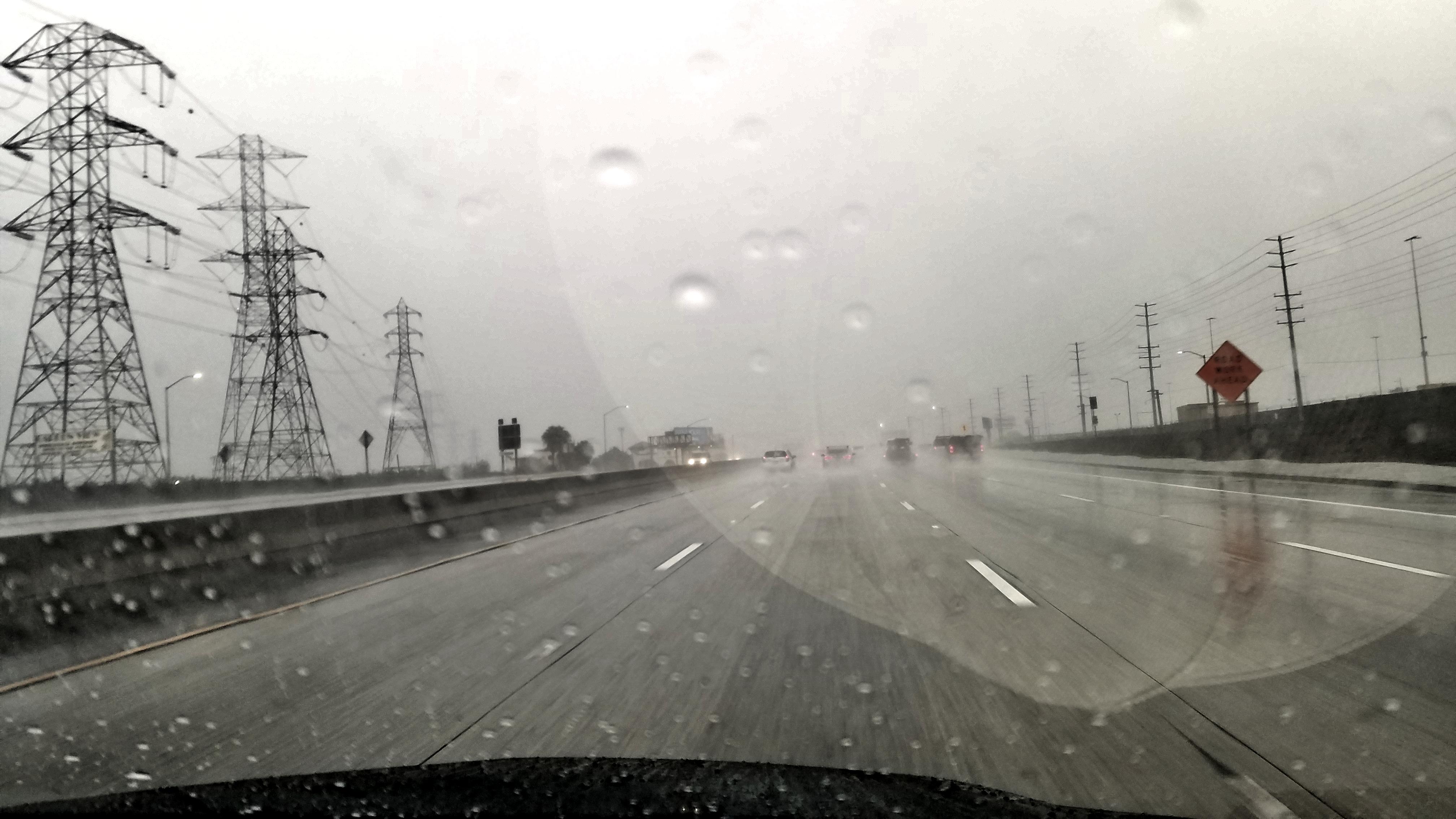
On this day, it was pouring rain on the road there but the forecast said it would stop at about 8 am. And just as predicted, it mostly stopped by the time we parked the car. It only took us about 45 minutes from my house in Cypress, CA. He picked me up and we intentionally came a little early for the parking.
Being Saturday, the parking lot was already almost full. There were only a couple of spots left on the upper level. Maybe we got lucky because the early morning rain kept cyclists away. On our way back down, we’d see that the parked cars on the side of the road stretched 1/2 to 3/4 of a mile down the road even though there still were no cyclists going up and down the road. The lack of adequate parking or rather the popularity of Sturtevant Fall is usual.
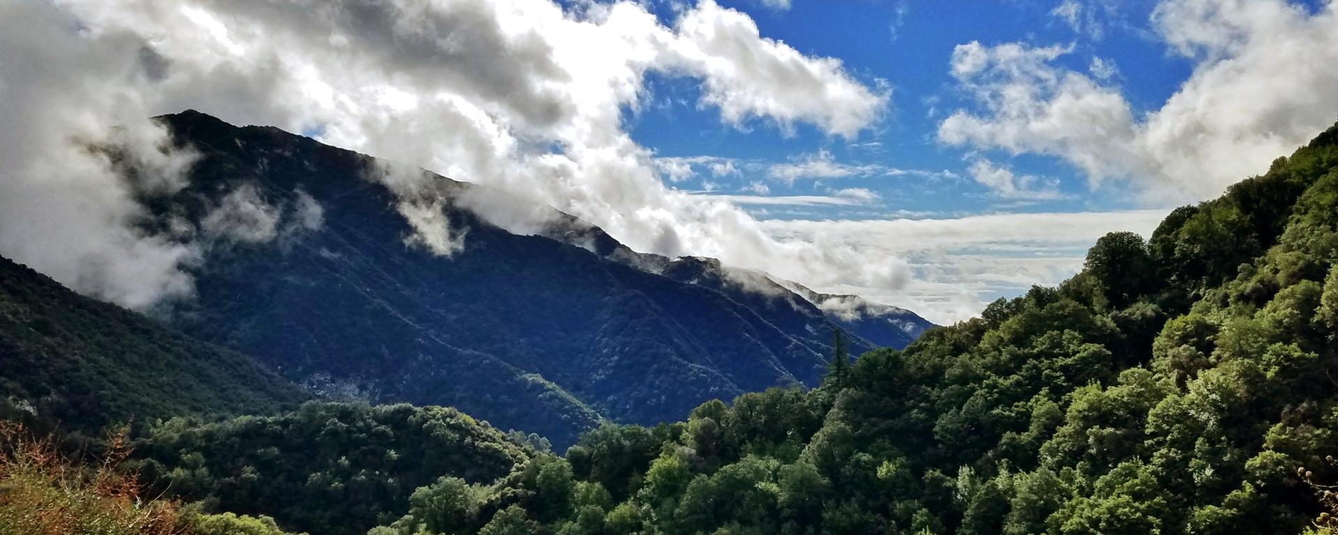
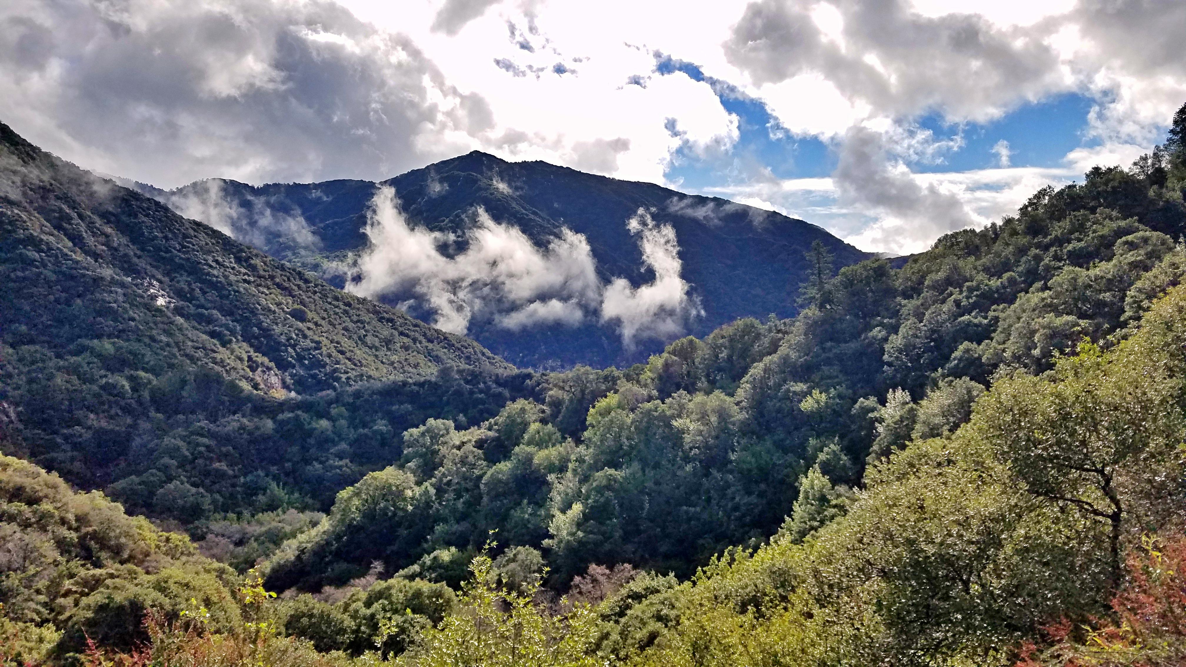
To be sure, one of the highlights of hiking on a cloudy day is witnessing the dance between the clouds and the mountain.
The Weather
Since it was Alex’s first time at Santa Anita, I showed him the Chantry Flat (altitude 2,164 ft) before heading down: Fire station, picnic area, little shop, and pack station. You used to be able to pick up a free trail map outside the store, but it seems they stopped providing that.

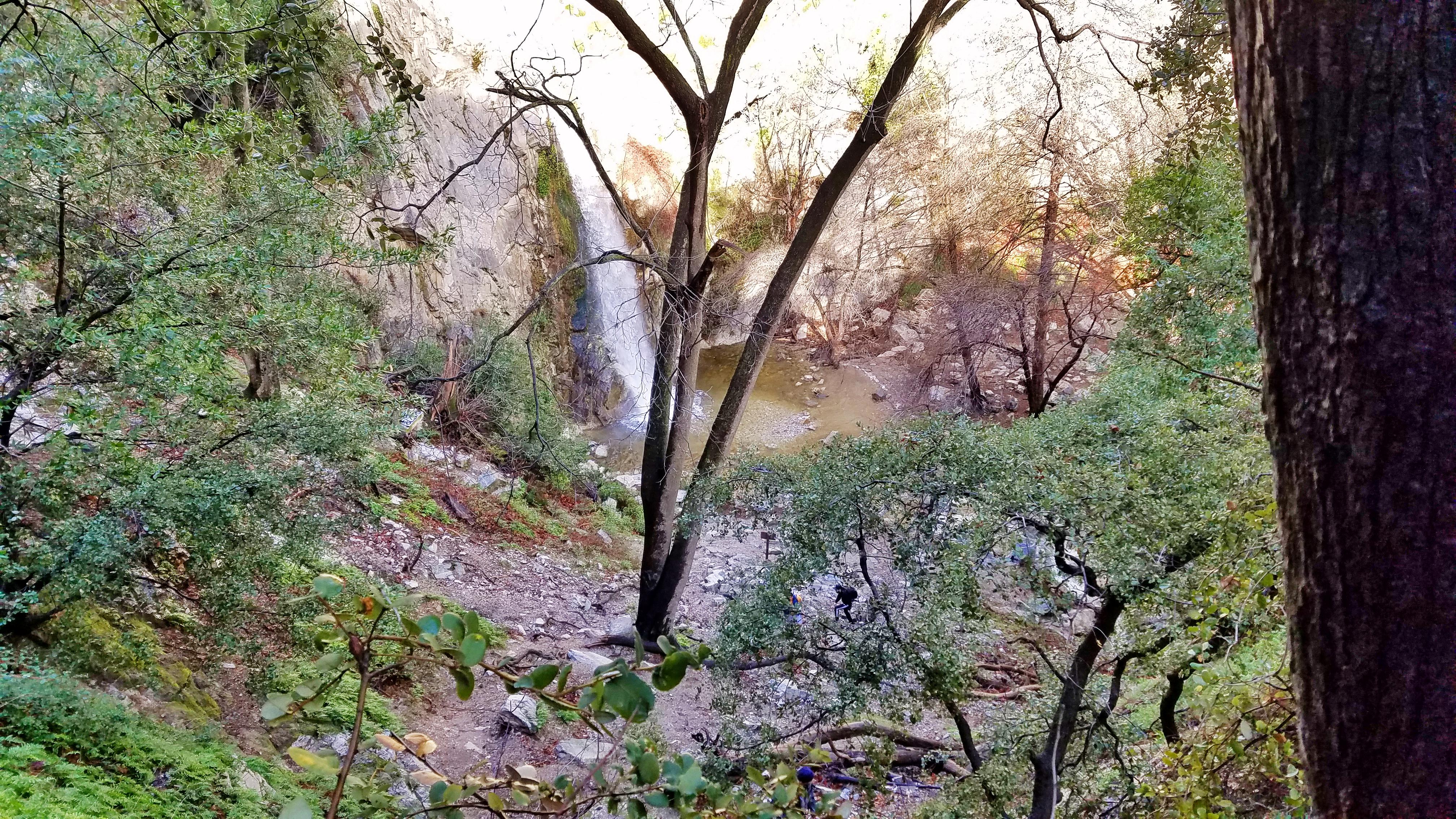
Of note, due to the recent rains, the creeks were perhaps fuller than at any time before, at least as far as I could remember. In several spots, it was tricky crossing without the risk of slipping into the water and getting your feet wet or worse.
We did manage not to slip and get our feet wet. Definitely, while it can be lovely hiking in a little rain, care should still be exercised so you don’t slip.

Of course, you should avoid the canyons in the pouring rain as flash floods could occur. Indeed, in some sections, it did appear that the water washed away short sections of the trail. Many trees were also downed.

During the hike, however, we avoided hiking in the rain. The only time we got wet was when we got a little sprinkle near the Mt. Zion summit.
And because the rain shower was so light and brief, it was enjoyable. The moisture made the leaves glisten under the sun.

The Trail
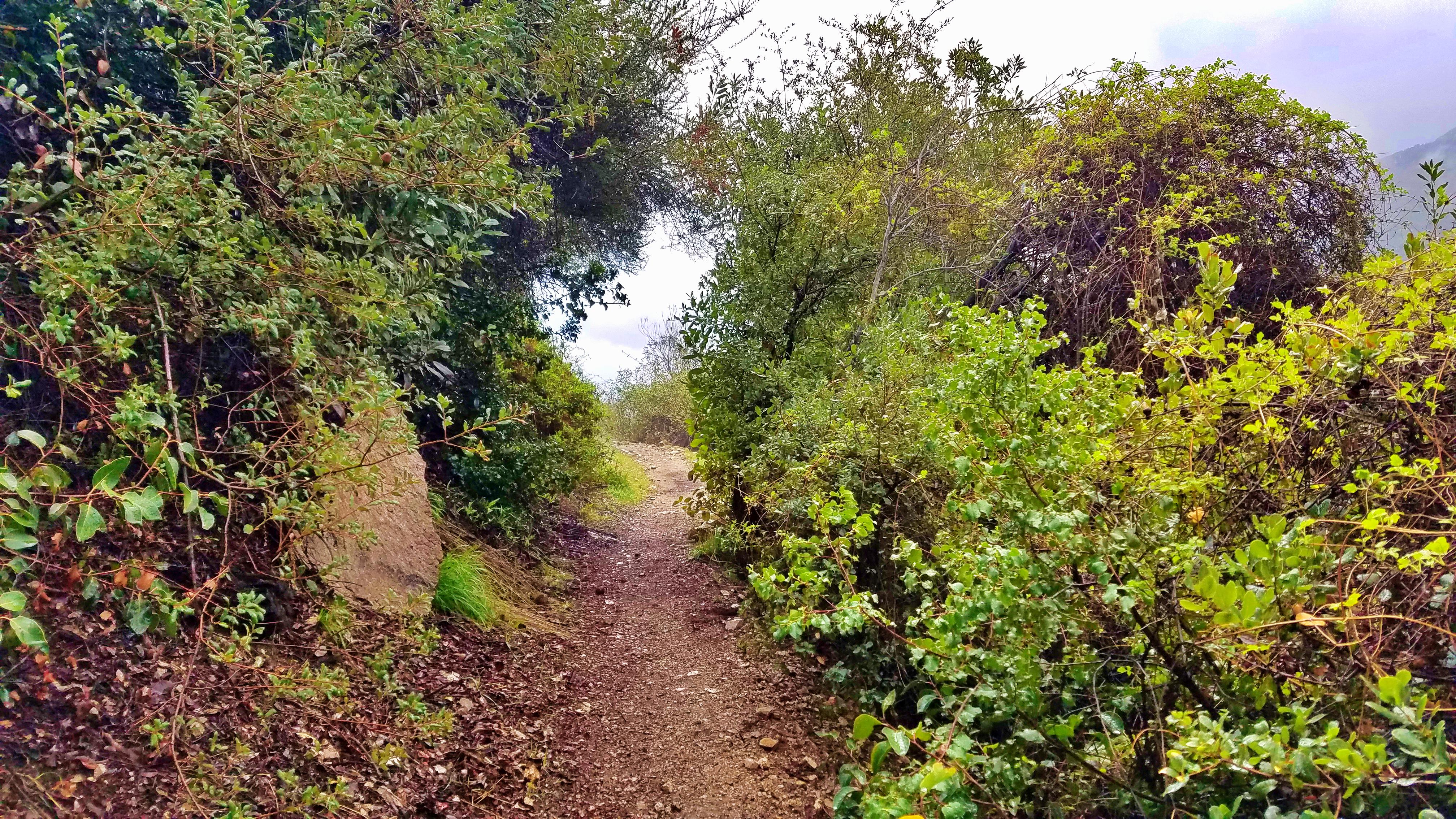
The moderate Mt. Zion (altitude 3,533 ft) loop trail (7.8 miles) remains one of my favorite local trails. It starts down the paved road (Santa Anita Canyon Ave) from Chantry Flat.

At the bottom of the road, you usually can cross the creek without using the bridge (altitude 1,824 ft), but you could not do it this time without getting wet. So the bridge was a must to keep the feet dry.
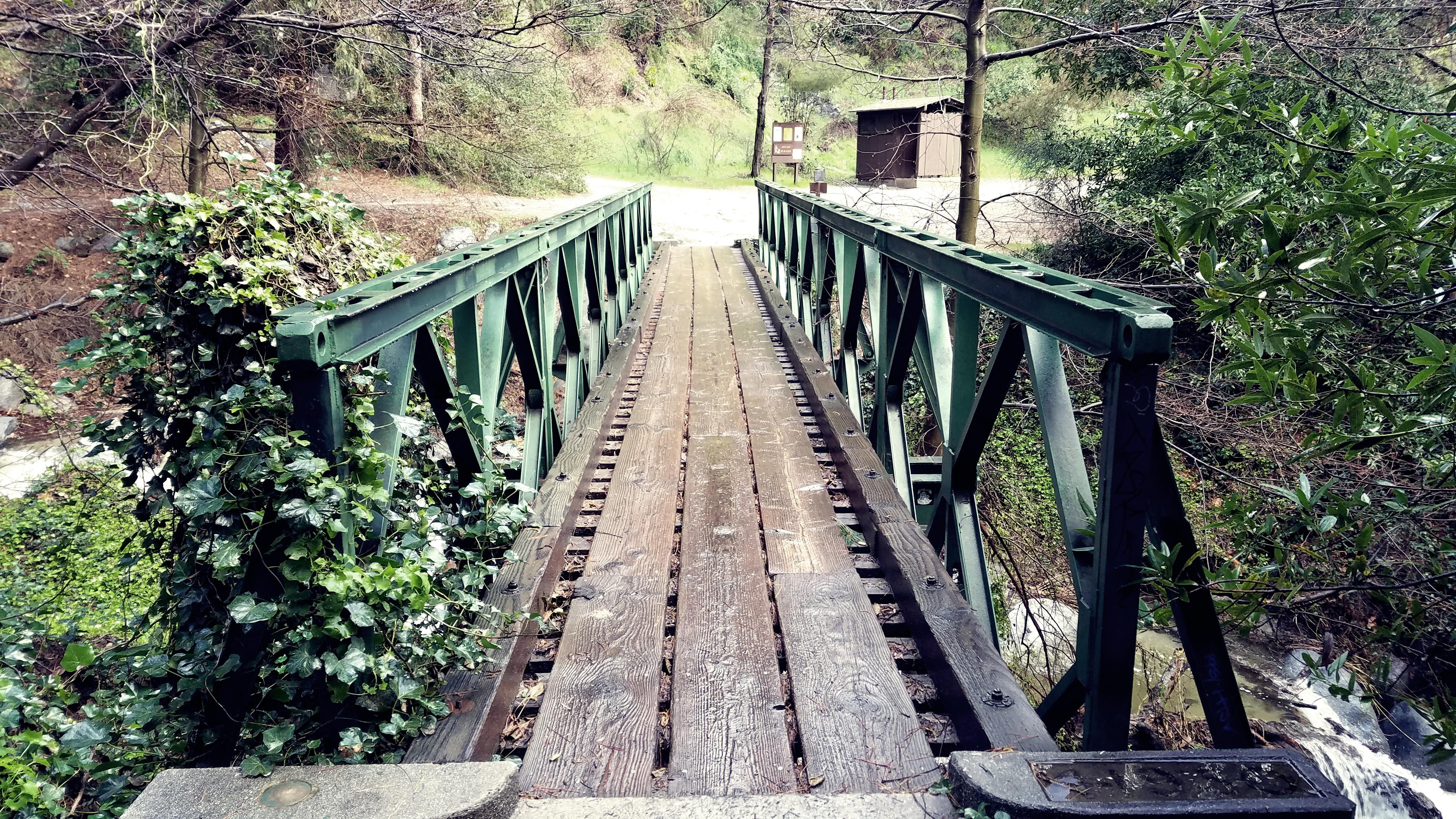
After the nice bridge, you could either go up the Winter Trail or continue on the Gabrieleno Trail to Sturtevant Falls, which my friend Alex and I chose to do.
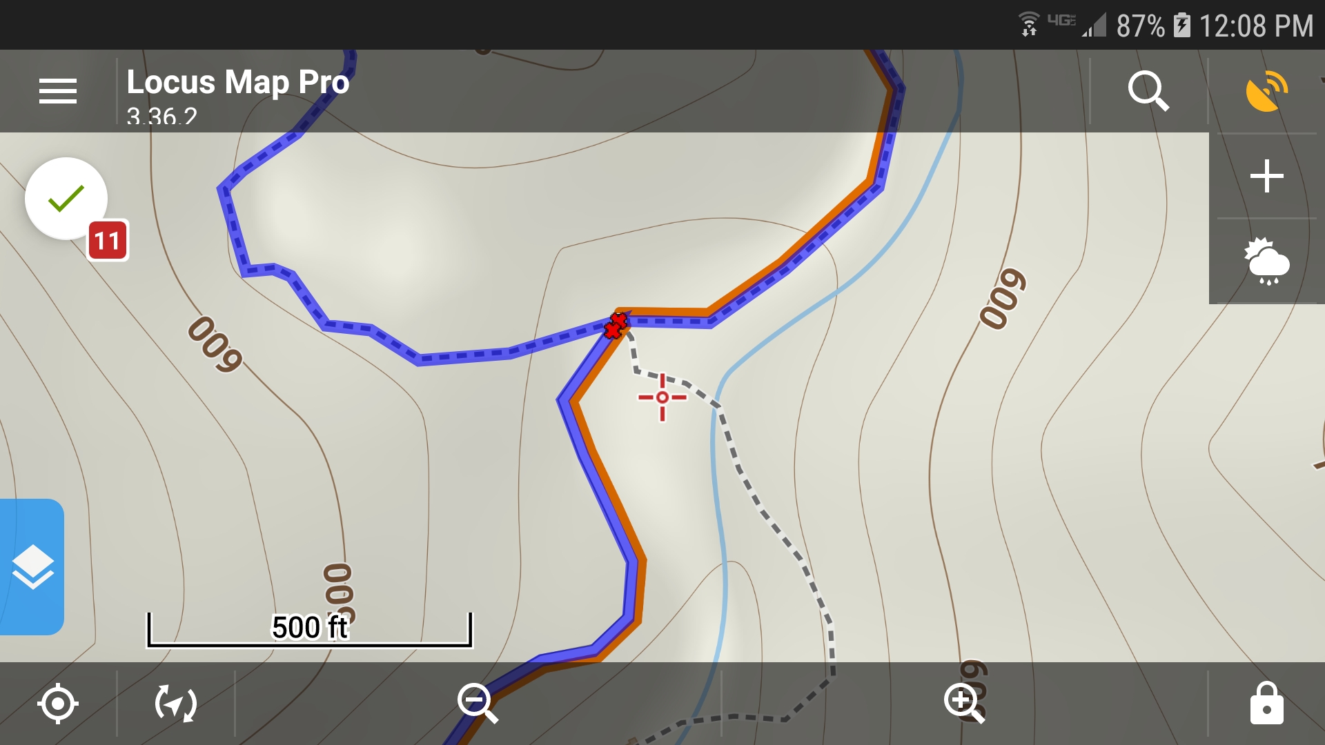
About half a mile before Sturtevant Fall, there is a junction. Go straight to go to the fall or take one of the two trails on the left to go above the fall. The first one is obvious but the second trail is less so. Both meet up again about one mile past the fall. Of the two, I like the middle one because it goes right over the fall and has more interesting and rocky formations and cliffs carved by the creek.

From above the Sturtevant Fall, you continue on the Sturtevant/Gabrieleno Trail past the Cascade Picnic Site and the Spruce Grove Campground until the two trails split just before the Sturtevant Camp.
You should not take the Gabrieleno Trail northeast to the right. If you took that, in time, you could connect to the Pacific Crest Trail and visit other major peaks in the region, maybe in a day or so.
Just past the Sturtevant Camp, you come to the Mt. Zion Trail junction. From there it’s only about 1.1 miles up to the summit of Mt. Zion.
From the summit, it’s all downhill back to the bridge by way of first the Mt. Zion Trail and then the nice Winter Creek Trail via the Hogee Campground. Both trails are very scenic. Actually, it’s not all downhill. Perhaps, one of the challenges is having to walk up the paved road back to Chantry Flat!
Sturtevant Camp
Of note, normally the trail leads you past the Sturtevant Camp. I’ve always walked passed the camp. Usually, you don’t see much activity there. However, the recent rains seem to have washed part of the trail away. As the result, the detour led straight through the camp.

As we were passing, we heard voices in the cafeteria – the larger building compared to the individual cabins. I had never actually seen the inside (except perhaps photos) so we knocked on the door to see if we could purchase a cup of coffee. The kind people inside said that no retail services were available but we could help ourselves to a cup of hot tea.

It was a nice rest while a group of teenage guests played some board game.
The Swiss inspired Sturtevant Camp takes reservations for cabin rentals. So it is an option if wish to spend the night in the woods but not tenting at one of the campgrounds.

Conclusion
The Santa Anita Canyon is big enough that despite the ever full parking lot, it is not crowded on the trails. Once you go off the main trail that goes to the fall, you are often hiking alone with only a few people around. It is still trafficked enough that you occasionally encounter people coming down, passing you, or who you pass.

I particularly enjoy these canyons in spring or after the rain because the streams come alive and the plants turn very green. There are also many flowering plants during the spring and early summer. I do tend to avoid the Santa Anita Canyon in the late summer when the water comes to a trickle, the trails become dusty, and more insects get thirsty for your blood. The fall and winter provide ample excuse to resume coming to the Santa Anita Canyon.
The term Mount Zion has been used in the Hebrew Bible first for the City of David (2 Samuel 5:7, 1 Chronicles 11:5; 1 Kings 8:1, 2 Chronicles 5:2) and later for the Temple Mount, but its meaning has shifted and it is now used as the name of ancient Jerusalem’s Western Hill.
Source: Wikipedia

Nice writeup and website. The brief videos were cool too.
LikeLike