
Going beyond the trail
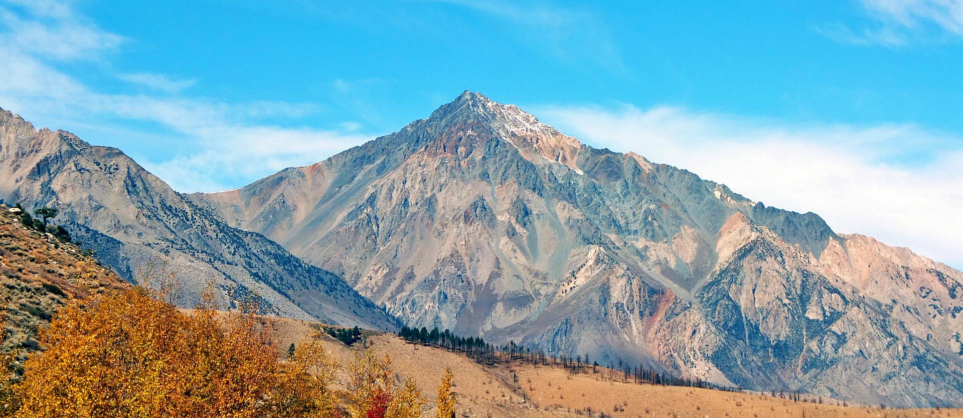
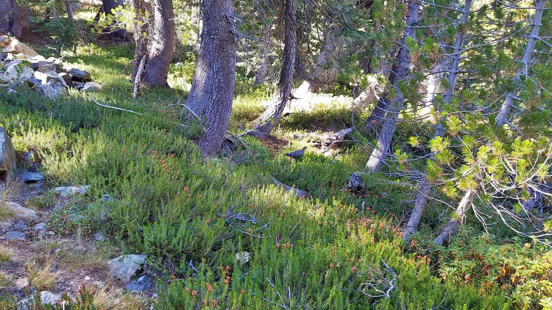
Staying on the trail is the safest thing to do. You minimize the risk of getting lost or falling down. It’s also the easiest way to hike. Most of the trails on the maps are well-defined and well maintained. On heavily trafficked trails, you also protect the landscape. But occasionally, while traversing over mountains and through the valleys, my eyes fixate on the tall imposing summits that pass by. Each time, they beckon, “Come hither.” I respectfully reply, “No way.” Indeed, the mountains, like Mt. Tom below, are often scary and austere as they are beautiful and magnificent. I fell like a small mouse compared to some of the great mountains in the Sierra Nevada.
(You can click on the photos for a larger image.)
Sierra Peak Section, The Sierra Club
Thanks to my friend Alex, who I joyfully introduced to hiking earlier this year, I learned about the Sierra Peak Section (SPS) of the local Angeles Chapter of the Sierra Club. The Sierra Club is a great group to join if you wish to go hiking frequently with known and likely, reliable comrades. They are also politically active in protecting and preserving the natural environment for future generations of hikers. Now with the Club, Alex has become a hiking maniac, going out almost every weekend on very long hikes. Actually, I think it was I who recommended Alex to the Sierra Club, but I prefer solo hiking so I didn’t need to join a club before. I did not myself know about the SPS, a group of people that “explores, enjoys, preserves, and stimulates interest in climbing and hiking up peaks in the Sierra Nevada.” But now, the SPS may be just the group I need. It is true, I often get the urge to climb the summits.
SPS Membership
But first, the red tape: How to join. They have a recommended list of peaks called the SPS Peaks List that names about 250 summits (yes, “peak” and “summit” are interchangeable) in California’s vast 400 mile long Sierra Nevada. To officially join the group, you have to have climbed six of them. Beginners should probably start with peaks from the Sampler List (SPS-SL) consisting of 100 Class 1 and 2 peaks (see below on the class classification system). There’s a few Class 3s on the list which I’ll avoid for now. Actually, as far as I can see, for the rest of my short life, I’ll probably restrict myself to Class 1 and 2. I no longer feel immortal. I tried rock technical climbing in college but never picked it up again after marriage and having kids.
Mountaineering Classification System
Briefly, according to the classification system developed by members of the Sierra Club, Class 1 means there is a maintained hiking trail to the peak. This is like climbing Mt. Baldy locally in the San Gabriel Mountains or Mt. Whitney in the Sierra Nevada. Class 2 means that there is no trail and you might have to use your hands and knees at times. Class 3 means you may have to use a rope. In Class 4 and 5, you will be using rock climbing techniques and equipment. Thus, my goal for next year is to climb at least six peaks from the SPS-SL and officially join the SPS. In the meantime, maybe I can follow along on some beginners’ instructional trips.
Sawtooth Peak Attempt
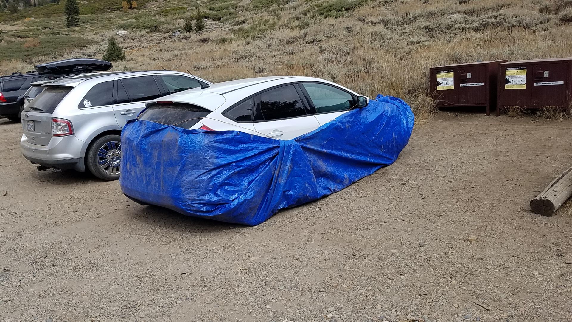
For the first summit, I chose a Class 2 Sawtooth Peak (good source of information at PeakBagger.com and SummitPost.org). The only reason I chose it was because I had been in the area before and it appeared easily accessible. The peak is located in the remote Mineral King region of the Sequoia National Park. In the summer of 2018, I camped one night at Cold Spring and day hiked to lower Monarch Lake (there are two lakes which are collectively called Monarch Lakes). On this trip, over the October 19-20, 2019 weekend, I went directly to the ranger’s station, self-registered, grabbed a tarp to make the car Marmot Proof, hiked directly up Monarch Lakes with a 40 lb backpack, set up camp at the lower Monarch Lake, and attempted my first major scrambling up a large mountain. The weather forecast was for clear and warm day (check out Moutain-Forecast.com and Google Mineral King Ranger Station Weather).
Well, as it sometimes happens, it did not go as planned and I turned around about half way up the ridge between Sawtooth Pass and the Sawtooth Peak above the upper Monarch Lake.
Safety First
Now in hiking, regardless of the class or location, you must be ready to turn around for safety reasons: Safety First. There is no such thing as failure to summit or to hike. You do the best you can considering the environmental and personal conditions. If it does not feel right, internally or externally, there is no need to risk personal safety to reach a hiking destination or a summit. There is always next time, thousands of times over. The mountain will welcome you back with open arms any time you are better prepared than today. If you are not ready, be careful: The mountain does not care and it might be your last hike. Remember: I’m only a mouse compared to the great mountains. (Note: It’s a different kind of anthropomorphism than to say, “I conquered it.” You don’t conquer a mountain, you conquer yourself.)
Not in the best condition
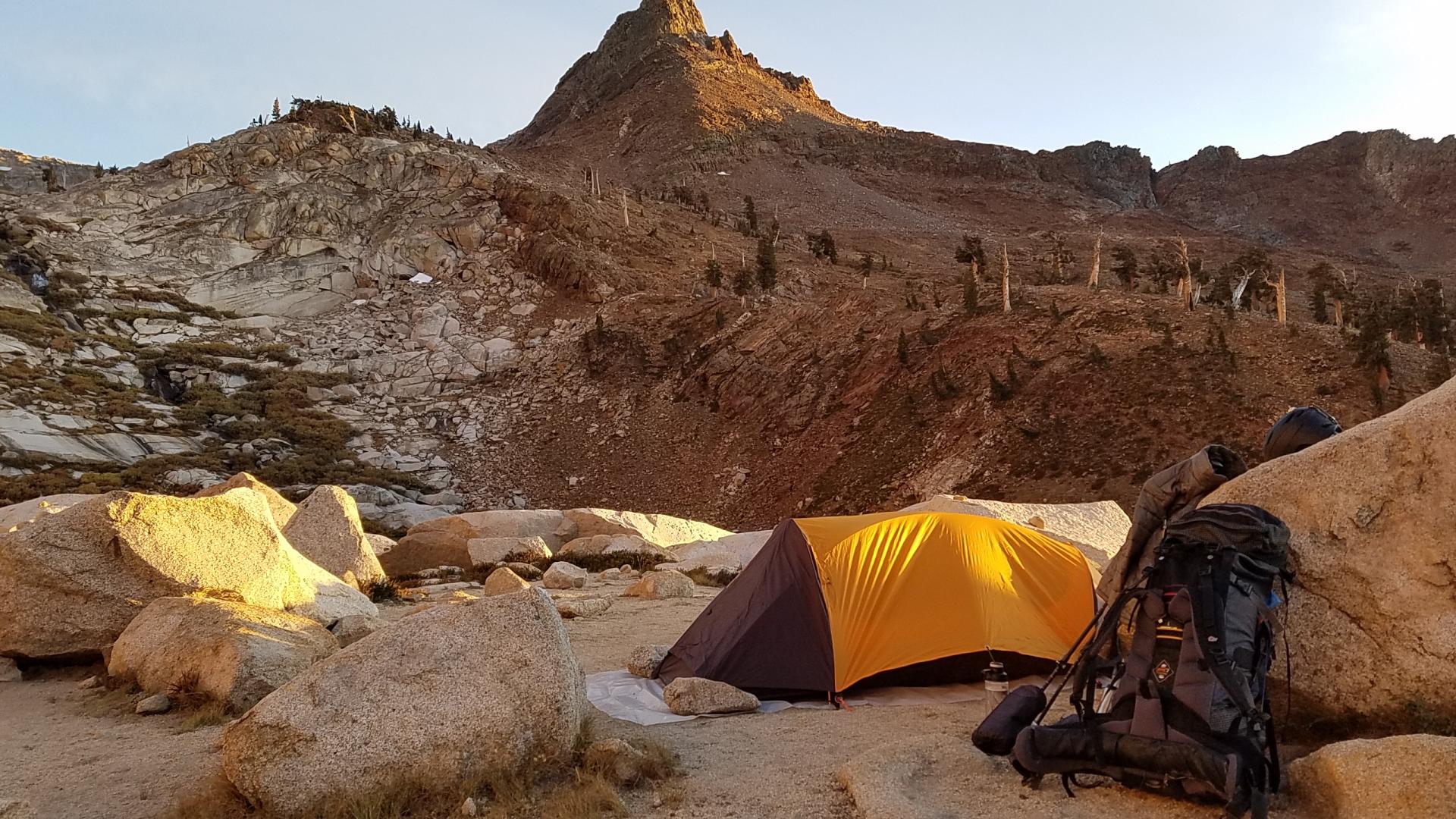
So what happened? The day before the trip, I spent a lot of time modifying a single person tent I had bought a few years ago. It did not cost too much but I could not throw it away (I am more likely to give it to a friend, donate it, or keep it as a loaner than to throw anything away). I replaced the poles and added two more, making it much stronger now – which now likely can withstand a pile of snow (but there’s really no space inside to sit up, change, or adjust the sleeping bag). The night before, I also went to see a movie and grab a dinner with my wife- the soju at dinner probably did not help. So maybe I slept at 11:30 pm and woke up at 4 am. I packed up, started the drive at about 5:50 am and got there by 11:30 am and began the hike after a bite to eat and wrapping up the car (from the marmots) at about 12:30 pm. With a 40 lb pack, which I am not used to, it was hard going up. The last two mile was difficult enough but I struggled with the last mile, with shortness of breath, a headache, and lack of energy. I was not in the best of conditions. But by taking it slowly and taking a lot of breaks, I made it to campsite at the lower Monarch Lake.

At the campsite, there was only one other party who were out of view about 50 yards away, a couple of guys fishing the lower Monarch Lakes. I found a secluded spot a bit above the ranger installed toilet, pitched tent, and cooked dinner out of freeze-dried food; it was not very good and I ended up not eating all of it – likely due to my exhausted condition. The night was warm enough, likely only reaching below freezing a few moments, as I noticed there were only a few ice crystals in the water bottle (I kept one in the sleeping bag) the next day, but I could not get deep sleep. My heart rate seemed to be elevated, I still had the headache, and I had a lot of silly dreams. Still, I was able to get out at the moonless night and enjoy the the peace under the Milky Way. Referencing my astronomy app, I was able to locate Saturn and Jupiter. By early morning, the headache was mostly gone, and I felt rested. It felt good to get up up in the moonlit darkness, cook and eat my sardine-ramen breakfast, pack up, and see the beginnings of morning glow in the sky. Over night, I had recovered for the most part and avoided getting worse. It would have been bad if I had to retreat down in haste in the middle of the night. I prepared to climb.
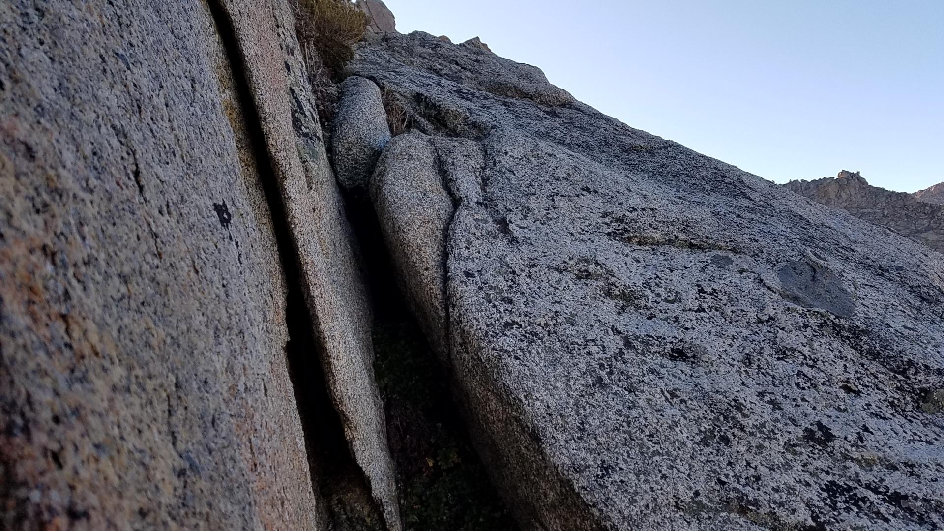
An obstacle
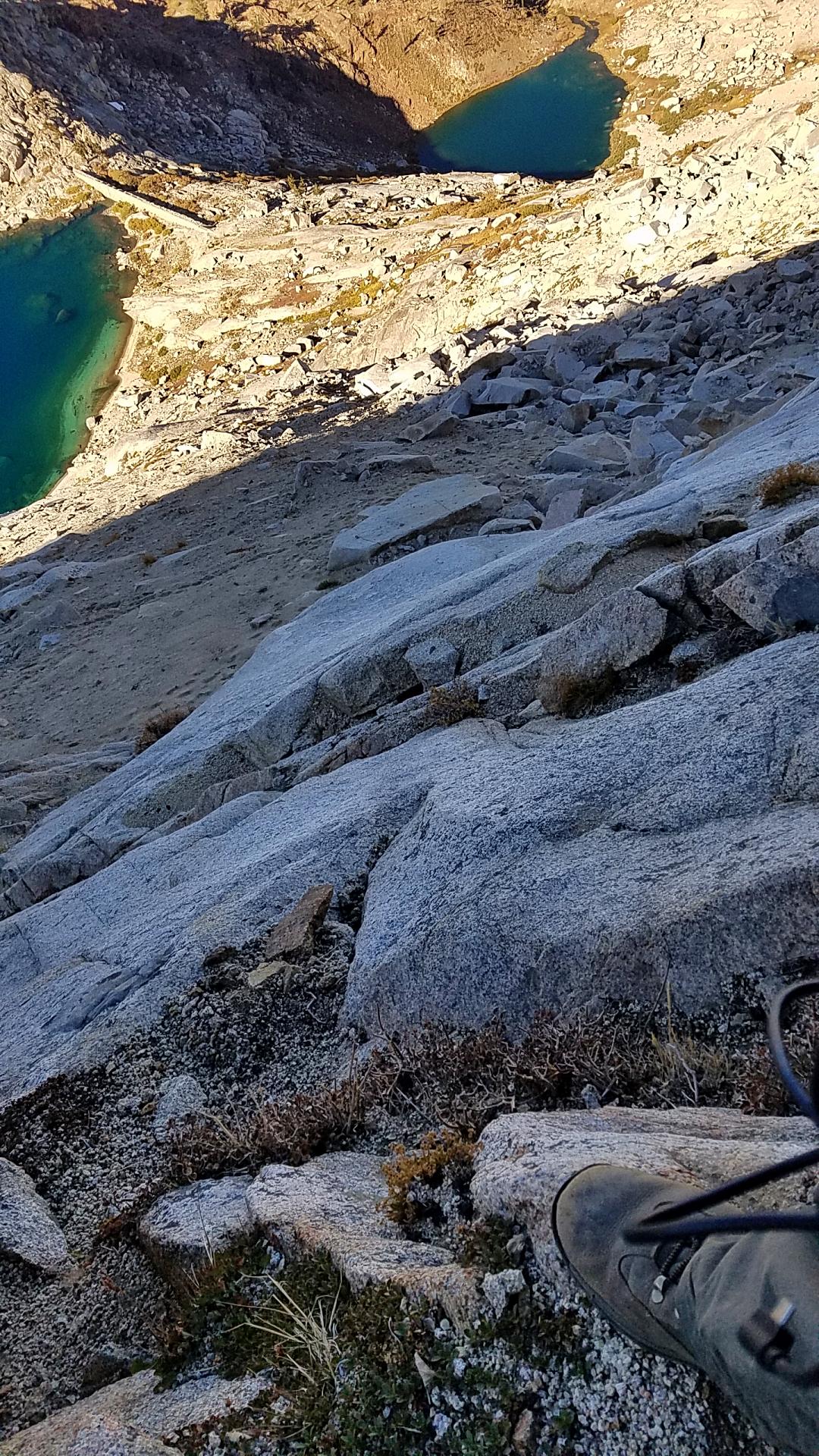
It began alright up the trail leading to the Sawtooth Pass. It was just like the any other time I got on any other trail after a night in the wilderness. That was until I decided to get off the trail and take a shortcut up to the ridge between the Pass and Sawtooth Peak. Looking back, for my first time that high, I probably should have stuck to the trail to the Pass and hiked along the ridge to the Peak. Instead, things got interesting: Scrambling is a different level of hiking. The route was not obvious. I eye-balled it and tried to make my own path to the ridge avoiding possible obstacle and traps. Sometimes my paths joined other foot prints but often there were none. Occasionally, I used my hands for supporting, securing, and pulling. Perhaps I reached about half way up the ridge above upper Monarch Lakes before I decided to call it a day. With my large backpack, which I am still getting used to, I felt I could not safely overcome an impasse which required the use of my hands but did not afford space to possibly keep myself from falling backwards. Being not in the best of conditions, it was the right call.
I carefully scrambled down the rocks and skipped and hopped down the graveled slope to the upper Monarch Lakes shore. There I enjoyed my snacks and a nice rest amidst the splendor of the surrounding mountain and the calming sound of the lapping water on the rocky shore. I made my way down the trail connecting the two lakes and came down to the trail head at a decent pace.
No such thing as failure
So was it a failure? Nah. It’s always great to return to wild: Get away from the city, leave your troubles and work behind, get on the road, drive into the mountains, breathe the fresh air, see the trees, hear the birds sing and the water trickle down the creeks, hear and feel your heartbeats, smell the plants and trees, and challenge one’s mind and body against the gravity and against oneself.
Altitude Sickness
The last mile to the Monarch Lakes was a real struggle and looking back. I probably had a mild case of altitude sickness (Acute Mountain Sickness or AMS). Though it was not severe, I should have been better aware of the symptoms (I was experiencing):
- headache (mild-moderate),
- dizziness (none, but difficulty focusing on ground far off the cliff),
- nausea (very mild), vomiting (none),
- fatigue and loss of energy (definitely),
- shortness of breath (kind of – but it’s common in high altitude hiking),
- problems with sleep (yes and headache at night), and
- loss of appetite (definitely at dinner).
Maybe I should have turned back before the lake (Safety First). But I monitored myself and didn’t feel it was an emergency situation, so I pressed on. It may be useful to write down the symptoms and carry it with you on the hike because you might not be thinking straight if you are suffering.

Optimal balance, equilibrium
The struggle and the challenge, both physical and mental, are part of hiking any tall mountain or part of hiking long distance. One of the joys of hiking is finding that balance in the process of doing between pushing yourself and finding an equilibrium, a good pace when your body seems to be optimally and indeed joyfully working in harmony in the natural environment. However, sometimes it’s a difficult to know when you have pushed yourself too hard, too far, or too fast over your physical edge. Your state of mind and attitude, when the conditions are imperfect, can play a part to obscure rational calculation of both the internal and external challenges. When the conditions are right, you reach new heights of achievement and indeed, being. But if they are not, you can make mistakes and get hurt. You might even be lucky to survive.

Anyway, in hiking, it is not so relevant whether you reached your hiking destination or the peak so much as the fact that you went out into the wild, challenged yourself, had a good time, and came back in one piece. You come back a better for it because the real challenges and the journeys are within yourself, not outside. Ultimately, a good hiking trip is one where you come closer to who you are in essence which closer to being alive and closer to the universe. You realize again that when you gaze into the Milky Way through the opening in the immense valley without ambient city lights, all quiet, and you feel so small but also eerily at peace as the worldly concerns fade away in the wake of the stark beauty of the moment.

So no problemo – it all worked out. A sign at the Sawtooth trail head said that the road would be closed on October 30th. I’ll return next year to complete the summit.
